RSS

Category Archives: Trails and hiking near the Lodges!

NEW exclusive concierge service for our Lodges!

Exclusive service

Exclusive service

NEW exclusive concierge service for our Lodges!

  NOW offering transportation to and from Denver’s airport or train .  The price would be  500.00 for up to 10 people and gear.  I.e. bikes, kayaks, climbing gear , skis, golf clubs I will also offer individual rates of 60.00 per person with a minimum of 4. Destination transportation will be dependent upon distance and logistics.


Hut trips in Colorado!!


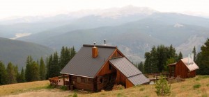
Get to know Colorado by visiting the 10th mountain Division Huts! 
 

Trailhead Directions and Details

Take special care with trailhead location. Allow extra time the morning of your trip in case the trailhead is not plowed or otherwise difficult to find or use. Check “New & News” on this website for critical trailhead changes. As parking at trailheads is often limited, please carpool or use a shuttle service whenever possible. Click here for GPS information.

ATTENTION HUT USERS: Due to break-in’s at a few of our trailheads we stongly urge all hut users not to leave anything of value in your car. If you must leave something in your car make sure it is either locked in your trunk or well out of sight.


Aspen Area Trailheads

Hunter Creek Trailhead
ELEVATION: 8,380 feet
10TH MTN MAP: Smuggler Mtn
USGS MAP: Aspen

To reach the Hunter Creek Trailhead, start in the town of Aspen. Follow Main Street in Aspen to Mill Street (the stoplight near the center of town, next to the Hotel Jerome). Turn N on Mill and drive a short distance down a hill, then across a bridge over the Roaring Fork River (.25 miles). Bear left after the bridge and follow the Red Mountain Road 1 mile to its second switchback. Just before the switchback, turn right and downhill on the Hunter Creek Road. Drive approximately .3 miles on Hunter Creek Road, then take a hard left on an unpaved driveway that leads up past a water tank 300 feet to a parking area. The actual trailhead is farther up the mountain, but this is the only parking.

You have several choices for foot travel to the actual trailhead. The simplest method is to walk back down the driveway to the Hunter Creek Road, turn left through two stone gate posts marked “Private,” and follow the paved Hunter Creek Road 1/3 mile around a hairpin switchback to the well-signed Hunter Creek Trailhead on the right side of the road. Your other choice for foot travel is to follow a foot trail that traverses up the mountain from the parking area to the trailhead.

Print These Directions

New Upper Hunter Creek Trailhead
ELEVATION: 8,400 feet
10TH MTN MAP: Smuggler Mtn
USGS MAP: Aspen

For the New Upper Hunter Creek Parking Area follow Hunter Creek Road up Red Mountain (See Hunter Creek TH directions) and go NE through the stone pillars continuing up Red Mountain Road for approximately 6/10th of a mile to a 3-way intersection. Take a very hard tight turn, and continue E 1/4th of a mile through two sharp swithbacks. You are now on private property. Please respect the homeowners and use the linked map to find the parking area. Do not enter private, marked driveways and do not cross the bridge. Upper Hunter Creek Trailhead Map


Print These Directions

PLEASE NOTE THESE IMPORTANT RULES FOR THE NEW PARKING AREA:

This is intended primarily as a skier drop-off area. Be prepared to drop your gear here and return your car to the Hunter Creek Parking area. There are a total of four (4) parking spaces in the skier drop-off area. Two are designated parking spots for 10th Mountain Division Hut users. One is for senior citizens and the last is for handicap parking. The parking spots are on a first-come first-served basis. If you are using it for overnight parking you must leave a copy of your confirmation sheet on the dashboard of your car showing the designated night(s) you will be at the hut. Your car may be ticketed or towed if you a) do not leave proof of hut use or b) are illegitimately parked in the senior or handicapped parking spot. Four-wheel drive is recommended.

Lenado Trailhead
ELEVATION: 8,640 feet
10TH MTN MAP: Smuggler Mtn.
USGS MAP: Aspen

From Glenwood Springs/I-70, travel east on Hwy 82 approximately 32 miles to Smith Way. (From Aspen, this intersection is approximately 8 miles west of Aspen). Note that this intersection is located .8 mile west of the turn-off to Snowmass Village/Snowmass Ski Area. Travel downhill on Smith Way for .5 mile, cross the Roaring Fork River, and continue to a 3-way intersection. Turn left (north) at Upper River Road, (CR 17) and travel North for 1.5 miles to the sharp right turn (east) onto the Woody Creek Road CR 18. Proceed approximately 8.4 miles through Lenado to the marked 10th Mountain winter hut parking area on your right. A sign, and a chain with a lock, marks the parking area. The combination for the lock on the chain is the same as the hut combination.

Print These Directions


Fryingpan River Drainage Trailheads

Spring Creek Trailhead
ELEVATION: 8,440 feet
10TH MTN MAPS: Mount Yeckel, Burnt Mountain
USGS MAP: Meredith

From the 4-way stop sign in Basalt at Two Rivers Road and the Fryingpan River Road, follow the Fryingpan River Road approximately 25 miles to the Eagle-Thomasville Road #400. Parking is available just east of the turn off to Road #400. Do not attempt to drive this road when it is wet, even with 4-wheel drive. This road is impassible when wet!

Print These Directions

Montgomery Flats
ELEVATION: 8,250 feet
10TH MTN MAPS: Mount Yeckel, Burnt Mountain
USGS MAP: Meredith

From the 4-way stop sign in Basalt at Two Rivers Road and the Fryingpan River Road, follow the Fryingpan River Road approximately 26 miles to a marked driveway on the North side of the road (the street number is 26501). Please park in the plowed designated area for hut users and do not block the driveway. From the parking area, follow the driveway northeast for 0.1 miles, then pick up the marked trail on the right. Please follow this marked trail and respect private property.

Print These Directions

Diamond J Trailhead
ELEVATION: 8,250 feet
10TH MTN MAPS: Mount Yeckel, Burnt Mountain
USGS MAP: Meredith

Parking for the Harry Gates Hut was changed in 2002. The new parking is 0.3 miles west (down valley) from the Diamond J Ranch. Please see Montgomery Flats Trailhead for more information.

Burnt Mountain Road Trailhead
ELEVATION: 8,830 feet
10TH MTN MAP: Mount Yeckel, Burnt Mountain
USGS MAP: Nast, Meredith

From the 4-way stop sign in Basalt at Two Rivers Road and the Fryingpan River Road, follow the Fryingpan River Road approximately 26.5 miles to a Y fork in the road known as the Biglow (on USFS map). A sign indicates Elk Wallow Campground. Take the left fork (North Fork Road #501) and drive 2.6 miles to where the well-signed Burnt Mountain Road (#506) turns off to the left (north).

Print These Directions

Norrie Trailhead
ELEVATION: 8,440 feet
10TH MTN MAP: Mount Yeckel
USGS MAP: Meredith

From the 4-way stop sign in Basalt at Two Rivers Road and the Fryingpan River Road, follow the Fryingpan River Road approximately 27.5 miles to the sign that says Norrie Colony. Turn right (west), travel across the bridge, and then up a short hill. At the top of the short hill there should be a plowed area. Park in the plowed area – DO NOT block the private driveway. The road to Twin Meadows leaves this area southwest of the short hill.

Print These Directions

Granite Lakes Trailhead
ELEVATION: 8,760 feet
10TH MTN MAP: Mount Yeckel, Upper Fryingpan
USGS MAP: Nast


From the 4-way stop sign in Basalt at Two Rivers Road and the Fryingpan River Road, follow the Fryingpan River Road approximately 31.5 miles to signs for Fryingpan River Ranch and for Nast Lake/Granite Lakes Trailhead. After the turnoff, a winding dirt road leads 1.1 miles to the obvious buildings of the ranch. This road has several steep switchbacks, so 4-wheel drive is recommended during snow season.

The Granite Lakes Trailhead is just after the bridge. For the trail to Twin Meadows and Margy’s Hut, follow the marked trail around Nast Lake and begin climbing S.W.

Print These Directions

Road 505 Trailhead
ELEVATION: 9,120 feet winter; 10,040 feet summer
10TH MTN MAP: Upper Fryingpan
USGS MAP: Nast, Mt. Champion

Road 505 is a dirt spur off the paved Fryingpan Road. It was built for maintenance on the Fryingpan/Arkansas water diversion project. In winter it remains snow-covered and is shared by skiers and snowmobilers.

From the 4-way stop sign in Basalt at Two Rivers Road and the Fryingpan River Road, follow the Fryingpan River Road approximately 32 miles to an obvious parking area on the right. A sign at the parking area says Fryingpan Lakes.

Print These Directions

Hagerman Pass Road Trailhead
ELEVATION: 9,200 feet
10TH MOUNTAIN MAP: Upper Fryingpan
USGS MAP:Nast

The Hagerman Pass Road Trailhead is at the start of the Hagerman Pass Road, which connects Leadville and the Fryingpan valley. From the 4-way stop sign in Basalt at Two Rivers Road and the Fryingpan River Road, follow the Fryingpan River Road 32.1 miles to the end of the pavement, then follow Hagerman Pass Road around the sweeping bend to the left.

Print These Directions


Trailheads reached from Interstate Highway 70

West Lake Creek Trailhead
ELEVATION: 10,300 feet
10TH MTN MAPS: Summer Eagle
USGS MAP: Fulford

From the I-70 Edwards exit (#163), travel south 1/2 mile to Highway 6. Drive W on Highway 6 .7 miles to Lake Creek Road. Turn S (left) and drive 1.7 miles to West Lake Creek Road junction. Turn right and continue 1.5 miles to the end of the pavement and another 1.1 miles to the parking area at switchback. (8220′). Please Note: This trail passes through wilderness areas where we are unable to mark the trail with blue diamonds. This, along with the fact that this route is seldom traveled, can make for very difficult route finding and is not a trail we recommend for inexperienced or first time hut-users.

Print These Directions

Sylvan Lake Trailhead
ELEVATION: 8,558 feet
10TH MTN MAP: Burnt Mountain
USGS MAP: Crooked Creek Pass

From the Eagle exit (#147) on I-70 drive south .2 miles to the roundabout. Drive 1.0 mile west on Hwy 6 until the roundabout and exit on Sylvan Lake Road. Travel 1.6 miles and take a right on Brush Creek Road (aka Eagle County Road #307). Travel 8.7 miles to a “Y” intersection. Take the right fork (West Brush Creek Road) and drive 4.6 miles to Sylvan Lake. Sylvan Lake is a small state park where you’ll find good car camping, small cabins for rent, and bathrooms.

Print These Directions

Yeoman Park Trailhead
ELEVATION: 9,060 feet
10TH MTN MAP: New York Mountain
USGS MAP: Fulford

From the Eagle exit (#147) on I-70 drive south .2 miles to the roundabout. Drive 1.0 mile west on Hwy 6 until the roundabout and exit on Sylvan Lake Road. Travel 1.6 miles and take a right on Brush Creek Road (aka Eagle County Road #307). Travel 8.7 miles to a “Y” intersection. Take the left fork (East Brush Creek Road) and drive approximately 6 miles to Yeoman Park. Turn right off of the main road and travel a few hundred feet along a short spur road (over a bridge) to the obvious parking area.

Print These Directions

Vail Trailhead for Commando Run
ELEVATION: 8,220 feet
USGS MAP: Vail East

The Vail Trailhead for the Commando Run is not signed, but it’s fairly easy to find. Follow I-70 to the main Vail Exit (Exit 176) at Vail Resort. Take the exit, then travel south to a traffic circle. Turn east out of the traffic circle onto the frontage road and drive .4 miles E to an intersection marked with an oversized stop sign. Turn right (S) here and follow Vail Valley Drive .4 miles to parking at the Golden Peak Children’s Skiing Center at the base of lifts 6 and 12. In the winter parking is highly regulated, so check the parking rules when you get there.

At any rate, you can skin up the ski area from here to start the Commando Run in Mill Creek. This is a grueling start for such a nice tour, so consider accessing the Commando Run from the Vail ski lifts. There has been talk for years of a one-ride ticket for just that purpose, so check for this option. To reach the Commando Run from the lifts you can get into Mill Creek from the top of lift 6; or take a more roundabout route, finally using the Orient Express Lift to reach the west ridge of Siberia Peak. In the summer you can ride the Vail Gondola most of the way up the mountain, then hike the ridge to Siberia Peak. Cyclists can take their bike up the Gondola and ride across the ski area to the Mill Creek Road.

Print These Directions

Vail Pass Trailhead
ELEVATION: 10,580 feet
10TH MTN MAP: Resolution Mountain
USGS MAP: Vail Pass

To reach the Vail Pass Trailhead, drive I-70 14.3 miles east from Vail or 5.4 miles west from Copper Mountain Resort. Take Exit 190 and park at the indicated overnight parking area. The Shrine Pass Road leaves from the parking area. It has good signage and is well used. Please note: For winter trips, hut-users must use the non-motorized winter-use trail to access the huts. Use of the motorized winter-use trail (Shrine Pass Road) may result in a $100 fine.

Print These Directions

Boreas Pass Trailhead
ELEVATION: 10,350 feet
10TH MTN MAP: Boreas Pass
USGS MAPS: Breckenridge, Boreas Pass

From the intersection of Highway 9 (Main St) and Boreas Pass Road (County Rd. 10) in Breckenridge travel east for 3.7 miles to the winter trailhead parking area.

Section House Reservation Info

Ken’s Cabin Reservation Info

Print These Directions

Copper Mountain Trailhead
ELEVATION: 9,820 feet
10TH MTN MAP: Resolution Mountain
USGS MAPS: Copper Mountain, Vail Pass

Parking: Summit Huts Association appreciates the generosity of Copper Mountain Resort in allowing hut guests to park at Copper Mountain. Park in the Alpine Lot (formerly known as East Lot), just off Highway 91. Directions: turn into the main Copper Mountain Resort entrance and make your first left into the north end of the Alpine Lot. Park in the area near the Transportation Center, which is designated for Janet’s Cabin. Post your parking permit on the dash and make extra copies if your group requires more than one vehicle. Take the free shuttle from the Transportation Center to Union Creek.

Janet’s Cabin Parking Pass and Info

Print These Directions

Red Sandstone Creek Trailhead
ELEVATION: 8,620 feet
10TH MTN MAP: Gore Range
USGS MAPS: Vail West, Vail East

Drive Interstate Highway 70 to the Vail Resort. Take the main Vail exit (#176). After exiting, turn north and drive a short distance to the frontage road (rather than heading into Vail). Drive the frontage road 1 mile west, then take a right on the Red Sandstone Creek Road. For the most reliable parking, head up Red Sandstone Creek Road .3 miles to a parking area on the left at a major switchback. If you park here, you’ll need to walk .4 miles on plowed pavement up and around another switchback to the start of the true Red Sandstone Creek Road, then an additional .6 miles on a plowed dirt road to the closure gate. To avoid walking the road, it’s worth exploring parking options farther up the road, especially in spring or during years with less snowfall. To do so, it’s prudent to use a 4-wheel-drive vehicle.

Print These Directions

Spraddle Creek Trailhead (for Eiseman Hut)
ELEVATION: 8,480 feet
10TH MTN MAP: Gore Range
USGS MAPS: Vail West, Vail East

Drive Interstate Highway 70 to the Vail Resort. Take the main Vail exit (#176). After exiting travel north to the roundabout and turn east onto Spraddle Creek Road. You’ll immediately see a Forest Service overflow parking area on your left (note this and use later if needed). Continue up the steep paved road .7 miles to the Spraddle Creek Estates entrance gate. Leave the pavement here by taking a hard right on the well signed Spraddle Creek dirt road, and continue .1 mile to the Spraddle Creek Ranch parking area. Be advised there is no parking at the Spraddle Creek Estates entrance gate. Parking at the Lower Spraddle Creek parking area can be difficult because of the popularity of this parking area. Please carpool and use the Upper Spraddle parking area if possible. Free overnight parking can be found at Red Sandstone Park, located 1 mile west of the main Vail exit (#176) at the intersection of Red Sandstone Creek Road and the frontage road. Free bus service (970-479-2178) is available along the frontage road.

Print These Directions


Trailheads from Highway 24 & Leadville

Red Cliff Trailhead
ELEVATION: 8,680 feet
10TH MTN MAP: Resolution Mountain
USGS MAP: Red Cliff

Drive I-70 5 miles W from Vail Resorts or 55 miles E from Glenwood Springs to the Minturn exit (Exit 171). Travel south on Hwy 24 approximately 10 miles to a left turnoff that leads a short distance down into a canyon and into Red Cliff. The Shrine Pass Road leaves from the northeast corner of Red Cliff. It is poorly signed but fairly obvious. If in doubt, ask any local where it is, and the USGS map shows it clearly as the only road up Turkey Creek. Once you find the Shrine Pass Road, the best place to park is in Red Cliff on any side street or in the lot by the Marshal’s office. You can also drive just over a mile up the Shrine Pass Road to the water tank

Print These Directions

Pando Trailhead
Elevation: 9,200 feet

Camp Hale Trailhead
Elevation 9,250 feet

South Camp Hale Trailhead
Elevation: 9,280 feet

10TH MTN MAP: Chicago Ridge
USGS MAP: Pando

These trailheads are located at the site of former Camp Hale, a huge, 3-mile long flat area on the Eagle River a few miles north of Tennessee Pass. Fifty years ago Camp Hale was home for two years to the men of the 10th Mountain Division of the U.S. Army, for which the 10th Mountain Division Hut and trail system is named. Only road-cuts and a few foundations remain.

Drive I-70 5 miles W from Vail Resort or 55 miles E from Glenwood Springs and turn off at the Minturn Exit (Exit 171) onto Highway 24. Travel south on Hwy 24 approximately 15 miles and look for a distinct parking area to your left with a sign reading “Resolution Road.” This is the Pando Trailhead. You won’t find a bridge over the river, but it might be worth looking for a snow bridge. Such bridges are more likely in mid winter. Your other option to ski 1/2 mile south to a vehicle bridge and then ski back up to McCallister Gulch. Please note: vandalism to vehicles was reported at this trailhead in February 2010.

To reach the Camp Hale Trailhead, continue from the Pando Trailhead 1.5 miles S on Highway 24 to mile marker 160. Look to your left for two stone gate posts and a plaque. Again, parking is straightforward and there is a great year-round permanent bridge at this trailhead.

For the South Camp Hale Trailhead, continue S on Highway 24 for .7 miles past the Camp Hale Trailhead. Look to your left for another distinct parking area. Again, you won’t find a bridge over the river, but due to the distance this trailhead can save you, it might be worth looking for a snow bridge. Such bridges are more likely in mid winter. Boggy ground exists in this area as well, and needs a thick mid-winter snowpack for coverage.

To reach these trailheads from the south (Leadville) drive highway 24 over Tennessee Pass to Camp Hale. The South Camp Hale Trailhead is 5.1 miles north of Tennessee Pass on Highway 24. Use the connection mileages above to find the other two trailheads.

Print These Directions

Tennessee Pass Trailhead
ELEVATION: 10,424 feet
10TH MTN MAP: Chicago Ridge, Galena Mountain
USGS MAP: Leadville North

Drive I-70 5 miles W from Vail Resorts or 55 miles E from Glenwood Springs to the Minturn exit (Exit 171). Follow Hwy 24 for approximately 22.5 miles to the well-signed Tennessee Pass. Parking is obvious on the west side of the road opposite the turnoff to Ski Cooper. If you’re coming from the south (Leadville), travel 8.9 miles north from the junction of of Hwy 24 and 91 to Tennessee Pass.

Print These Directions

Ski Cooper Trailhead
ELEVATION: 10,570 feet
10TH MTN MAP: Chicago Ridge, Galena Mountain
USGS MAP: Leadville North

To reach the Ski Cooper Trailhead from the north (I-70), drive I-70 5 miles W from Vail Resorts or 55 miles E from Glenwood Springs to the Minturn exit (Exit 171). Follow Hwy 24 for approximately 22.5 miles to the well-signed Tennessee Pass and the obvious road to Ski Cooper. To reach this trailhead from the south (Leadville), follow Hwy 24 north 8.9 miles from the junction of Hwy 24 and 91 (at the north end of Leadville) to Tennessee Pass. Travel 1/3 mile from the highway to the Ski Cooper parking area. Trailhead parking for Vance’s and Sangree’s is on the right side after you go through an entrance gate. Notes: 1. If you’re headed for Vance’s Cabin, there is NO parking at Forest Service Road #731. 2. You may encounter Ski Cooper snowmobiles and/or snowcats on the first ¾ mile of the suggested routes to Vance’s and Sangree’s. Please expect and respect all users.

Print These Directions

Crane Park Trailhead
ELEVATION: 10,137 feet
10TH MTN MAP: Chicago Ridge, Continental Divide, Galena Mountain
USGS MAP: Leadville North

Crane Park Trailhead : From the top of Tennessee Pass go south on Hwy 24 1.6 miles and turn right (west) off the highway onto a dirt road. There is a sign mounted on an antique road-grader for Webster’s Sand and Gravel. The most reliable and secure parking is in an obvious area within sight of the main road. To reach the Crane Park Trailhead from Leadville, follow the directions for Tennessee Pass Trailhead from Leadville via Hwy 24. About 7.3 miles from the junction of Hwy 24 and 91 at the north end of Leadville take a left onto the aforementioned road with the sign for Webster’s Sand and Gravel.

Print These Directions

Turquoise Lake Trailhead
ELEVATION: 9,760 feet
10TH MTN MAPS: Galena Mountain, Continental Divide
USGS MAP: Leadville North

From Hwy 24 and Mountain View Drive on the north end of Leadville, drive 2.8 miles west on Mtn. View Drive to a “T” intersection. Turn north (right) and cross the East Fork of the Arkansas River. Continue N 0.5 miles to the large parking area on the right.

Print These Directions


Trailhead from Highway 91 & Leadville

Buckeye Gulch Trailhead (for Sangree M. Froelicher Hut)
ELEVATION: 10,180 feet
10TH MTN MAPS: None
USGS MAP: Leadville North Quadrangle


The parking lot for the Sangree M. Froelicher Hut is on the north side of Highway 91 between mile markers 4 and 5. It is 4.6 miles from the junction of Highways 24 and 91 in Leadville, and 19.5 miles from Highway 91 and I-70 (Copper Mountain). It is marked with a 10th Mountain Parking sign visible from the highway and “Public Parking” signs are found at the parking area. PLEASE NOTE THAT THE FIRST 1/3 MILE OF THE SUGGESTED ROUTE FROM THE PARKING LOT TO THE HUT IS ON PRIVATE PROPERTY: RESPECT PRIVATE PROPERTY AND DO NOT TRESPASS. NOTE THAT PARKING IS NOT AVAILABLE ANYWHERE ALONG BUCKEYE GULCH ROAD AND VIOLATORS MAY BE TOWED AT THEIR EXPENSE.

Print These Directions
 

Posted by on November 8, 2012 in 10th Mountain Huts, Adventure Activities!, Silverthorne Area, Trails and hiking near the Lodges!

Comments Off on Hut trips in Colorado!!

Hikes to Hot Springs

The 1st 2 are within an hour of our Lodges!!

1. MAD CREEK/HOT SPRINGS TRAIL AND STRAWBERRY PARK HOT SPRINGS

Location: Steamboat Springs area
Hike: This sunny trail outside Steamboat Springs starts and ends right next to the Strawberry Park Hot Springs — an encouraging reminder of the reward that awaits after your workout. The aspen-laden path runs through meadows that are home to nearly 100 wildflower varieties and past Mad Creek Canyon landscapes and a postcard-worthy old U.S. Forest Service cabin. 4.5 miles round trip. More info
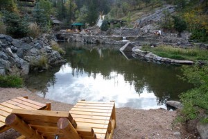
Hot Springs: Set amid a swath of trees four steep miles from town, the rustic Strawberry Park Hot Springs’ pools are encased by artfully crafted stone walls. Man-made waterfalls trickle sonorously into the water, and a small private pool is dedicated for watsu, a type of gentle, warm-water massage that will make the strain of your hike a pleasant memory.

2. GRIZZLY CREEK TRAIL AND GLENWOOD HOT SPRINGS

Location: Glenwood Springs area
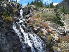
Hike: Cut into the north side of Glenwood Canyon, this challenging trail climbs 2,500 vertical feet alongside Grizzly Creek, a series waterfalls, lush forests and the canyon’s famously colorful walls. 7 miles round trip.More info
Hot Springs: Start your journey to relaxation in the Glenwood Hot Springs’ therapy pool, where Yampa Spring water is kept at 104 degrees and its 15 different minerals are purported to heal aching joints. Then hop in the massive, two-blocks-long big pool, kept at a chilly (by comparison) 90 to 93 degrees. Work out the rest of the kinks at the facility’s Spa of the Rockies, where the Kneipp Leg Release anti-inflammatory massage will focus on the muscles worked hardest during your hike.

3. ICE LAKES TRAIL AND ORVIS, WEISBADEN OR OURAY HOT SPRINGS

Location: Ouray area
Hike: A proverbial alpine paradise, this trail leads to several crystalline glacial lakes, gentle waterfalls tumbling over sandstone rock formations and views of several 13,000-foot San Juan peaks. Fields of paintbrush, buttercups, columbines and other wildflowers fill the basin that surrounds the lake at the end of the hike. 7.6 miles round trip. More info
Hot Springs: Choose from three hot-springs options in nearby Ouray. Orvis Hot Springs’ seven pools range from 98 degrees to a very steamy 112 degrees. The main, gravel-bottom “pond” is known for Mt. Sneffels vistas. The Wiesbaden Hot Springs Spa and Lodging offers a couple of soaking pool options, including one inside a natural vaporcave. The Ouray Hot Springs Pool is tailored a bit more toward families, with slides and shallow areas, but there are also good spots for restful soaks and a picnic-perfect green space.

4. GOULDING CREEK TRAIL AND TRIMBLE HOT SPRINGS

Location: Durango area
Hike: Elk sightings are common along this steep trail outside Durango, which climbs above the striated Hermosa Cliffs on several switchbacks before dipping in and out of a series of vibrant meadows ringed by aspen groves (and home to a meandering cow or two). 6 miles round trip. More info
Hot Springs: Trimble Spa & Natural Hot Springs is located five miles from Durango. Two geothermal pools range from 101 to 105 degrees, and a refreshing Olympic-size pool offers a welcome cool off — it’s kept around 85 degrees. There are also two saunas, a poolside lawn that attracts sunbathers and a spa with delicious treatments like the honey facial. The Music on the Lawn Series makes summer an especially festive time to visit.

5. CONUNDRUM HOT SPRINGS

Location: Aspen area
Hike and Hot Springs: This undeveloped (read: free!) but popular hot springs pool can only be reached via a rigorous eight-and-a-half-mile trail that begins near Aspen. The raw beauty of the mountainous setting, the 102-degree water and the quiet seclusion of the area make it one of Colorado’s most unique adventures. In 2008,Time Magazine called a dip in this natural pool one of 50 Authentic American Experiences. 17 miles round trip.More info


Posted by on September 25, 2012 in Activities for the Family, Adventure Activities!, Lodge News, Trails and hiking near the Lodges!

Comments Off on Hikes to Hot Springs

Get Outside! Hiking Mohawk Lakes & Continental Falls


The Basics: 
Distance: 6 Miles roundtrip to Lower Mohawk Lake, 6.8 miles roundtrip to Upper Mohawk Lake
Elevation: 1,700-foot gain
Directions: From Breckenridge, drive south on U.S. Highway 9. From the last stoplight in Breckenridge to Spruce Creek Road is about 2.4 miles, turn right on Spruce Creek Road. Drive about 1 mile to a well marked parking area and trailhead.

This is one of his favorite hikes in Colorado. I figured it was a good choice as one of my final hikes of the summer.


This is also a good place for a scavenger hunt of sorts. As you do this hike look for cabins, cabin ruins and even the ruins of a mining operation. Later I’ll tell you how many of these things I counted. You can see if your number is higher or lower.

The trail starts just outside Breckenridge, but it turns out there are two parking areas. We parked at the first parking area, 1 mile or so up the road at a sign saying “Spruce Creek Trail, Wheeler Trail Junction 1.8, Continental Falls 3.0, Mohawk Lakes 3.4.” We figured 7 miles was a good distance today so we thought we were in the right place. It turns out, you can drive another two miles up the road and cut the hike drastically. You may need a 4-wheel drive on that section of the road. Since we didn’t drive it, I can’t tell you.


Starting the hike here was a good choice for us. The trail is beautiful. It winds through thick forest with moderate elevation gains, it was actually a good warmup for what was to come. The best part about hiking through this area was listening to the trees creaking. It’s not often you hear that sound. We also watched a shower of pine needles come down when the wind would blow through. We found it a bit dark, but very quiet and peaceful. We even had two birds stop by and bounce around on the tree branches as we took a break for water and snacks.

Meadow where view opens up along Mohawk lakes trail.


At 1.8 miles in, you come to a trail junction with the Wheeler trail. Continue on just a few feet and you come to an open meadow. This gives you a beautiful view of what’s to come. You can see the nearby peaks and even the stringy Continental Falls, the waterfall where we had lunch. We took several pictures here and enjoyed our first view of the leaves changing.


We walked on about 0.3 miles and the trail ended at a parking lot. We figured this was the second parking lot. Don’t look for the trail right here, walk through the parking lot and you’ll find a trail sign; it says it’s .5 to Mayflower Lake, 1 to Lower Mohawk Lake and 1.5 to Upper Mohawk Lake.


This is where the trail starts to climb. Fortunately you know it’s not far now. Just before Mayflower Lake there’s another sign saying go right for Mayflower Lake, go left for Mohawk lakes and Continental Falls.


We decided to keep climbing and take some side trips on the way down. And climb we did. The elevation gain gets tough here at times. At least there’s lots to see. This is also where you need to start looking for items from the scavenger hunt. At this split you’ll see a few ruins of cabins.

Abandoned cabin that has been restored along the trail. Sign inside calls it “Continental Cabin”.


Continue on to the next split. A sign tells you to turn right for a view of the lower falls or continue on to the Falls and Mohawk lakes. At this split you’ll find one cabin ruin and a cabin that has been restored. It had a sign inside calling it Continental Cabin. It said it was restored for the enjoyment of guests. I’m not sure if you can stay inside, but it had the remains of a large fire ring and even a ladder to a loft. It was a nice surprise. And a good spot to get out of the wind and rain.


We decided to add the lower falls view for the hike down and continued up. The next sign we saw was a bit off trail. It marked a mine, and we added that for the list down. Then we came across a huge contraption of some sort. Some kind a lift and pulley system, likely for the mining operation. You can still see the huge cables here for lifting and lowering ore carts.

Lower Mohawk Lake near Breckenridge.


It wasn’t much further from here to Lower Mohawk Lake. But when we arrived, so did the wind. Windy enough that we took a couple pictures and decided to turn around. It’s not far from here to Upper Mohawk Lake. A ranger we passed said you can actually hike to Lake 3 and Lake 4 above Mohawk Lakes. We decided this was good enough. We typically eat lunch at our lake destination, but in this case we decided the waterfall would be a better spot.


We turned around and since the hike down was much easier, we decided it was time to take a few side trips. We stopped at that mine sign. Turns out if you take the little trail over to the sign, there’s not one mine entrance, there are two. One mine had water, the other didn’t. The warning signs explain it all the dangers; mines can collapse, they can have dangerous gases, etc. We took a picture and continued on.

Entrance to abandoned mine along trail.


The waterfall was definitely the place to have lunch. Typically waterfalls are not much to see in September, they’re much better in spring and early summer. Not Continental Falls. It was putting on a good show in September, which means it’s probably just amazing earlier in the year. We found a rock and had lunch. We also spotted our first ore cart down in the water.


On the way down, we also sidetracked to that lower Continental Falls view. It was also a good spot to stop. And we took the side trail to Mayflower Lake. While the lake didn’t impress me much, the trail to it goes right through an old cabin. It was weird to think we were walking through what use to be someone’s living quarters.


So, our totals? We saw two lakes, one waterfall, three mines, three ore carts, one restored cabin with a roof and sides and six cabins. I’m sure there’s a lot more cabins and ore carts if you keep an eye out. At the bottom of this note, I’ll have a list of where I saw mine so you can see if you spot the same ones.


I welcome your questions, comments and hiking suggestions. Just E-mail me at, bradfordg61@gamil.com
Previous hiking reports:(lower elevation hikes have a star)
Boulder:
Caribou Ranch*Mallory Cave*Marshall Mesa,Heil Valley Ranch* Forsythe Canyon*South Boulder Peak*The Boulder Flatirons*Walker Ranch*Bear Peak*Rabbit Mountain*Bald Mountain*Betasso Preserve*Wonderland Lake*
Golden area:
Forgotten ValleyChimney Gulch*Apex Park*
Jefferson County:
Mt. Falcon*Elk Meadow*
I-70 area:
Herman GulchChicago LakesChief Mountain
Rocky Mountain National Park:
Granite FallsTwin SistersBierstadt LakeChasm LakeLulu City & Little YellowstoneThe Loch, Andrew’s GlacierSandbeach Lake
Indian Peaks/James Peak Wilderness:
King, Bob & Betty LakesForest LakesArapaho LakesMitchell & Blue LakesJames Peak AreaHeart Lake
Northern Colorado: 
Homestead MeadowsDevil’s Backbone*Lake Agnes
Summit & Eagle Counties: 
Booth FallsMissouri Lakes
Grand County:
St Louis LakeWaterfall At Snow Mountain RanchGranby Ranch
Other:
Exploring Fulford CaveOur Favorite HikesOur Favorite Bike Rides


A rusted ore cart along the trail. I saw 3, how many will you spot?

Ore carts: waterfall, below Continental Cabin, on the shoreline at Lower Mohawk Lake.
Cabins: Continental Cabin, ruins of another cabin in same meadow, cabin you walk through on way to Mayflower lake, ruins of two others nearby, ruins of a cabin at trail split to Mayflower and Mohawk lakes.
Mines: two just off trail, tailings at Lower Mohawk Lake.


Posted by on July 18, 2012 in Activities for the Family, Breckenridge Area, Trails and hiking near the Lodges!

Comments Off on Get Outside! Hiking Mohawk Lakes & Continental Falls

Lilly Pad Pond Hike

This hike is a great starter /training hike. You can walk or drive to the trail head from our Lodge Door. Highly recommended for Family picnics. In Spring bring your bug spray.

http://www.summitcountyexplorer.com/HIKES/Lily%20Pond%20-%20Hiking%20Trail.htm


Posted by on July 17, 2012 in Family Reunions, Frisco Area, Silverthorne Area, Summer Activities!, Trails and hiking near the Lodges!

Comments Off on Lilly Pad Pond Hike

Climbing 14ers!

This is the link we use for all route information when climbing around our Lodges!

http://www.14ers.com/photos/photos_14ers1.php


Posted by on May 28, 2012 in Activities for the Family, Adventure Activities!, Lodge News, Trails and hiking near the Lodges!

Comments Off on Climbing 14ers!

Trail expansion!

More trails to OPEN!!!

A seven-year work in progress, the Golden Horseshoe Management Plan will soon move from the draft stage into the long-awaited final approval and implementation stage.The plan for how trails in the open space area near Breckenridge will be used, maintained and developed is a joint effort between the three management agencies: Town of Breckenridge, Summit County and the U.S. Forest Service. Though it covers recreation, the plan also includes guidelines for handling natural resources and cultural resources. The 8,900 acre area lies between French Gulch on the south, Colorado Highway 9 on the west, and the Swan River drainage on the north. It lies north and east of the core of the Town of Breckenridge.

Breckenridge Town Council approved the draft plan Tuesday. It now awaits the OK from the Summit Board of County Commissioners, which should take place in early March.

Breckenridge Open Space and Trails director Scott Reid said changes could still be made to the plan, but based on feedback from the county commissioners at their Tuesday meeting, he doesn’t anticipate anything substantive.

“There are no surprises in here as far as we’re concerned,” Reid said, adding that the appendices of the document show the “exhaustive public input” that came in through the years.

It didn’t go without contest, though.

“It was a contentious process,” Summit County Open Space and Trails director Brian Lorch said, though he added, “We have not heard opposition (or questions) in a couple years.”

The major hang-up in getting the Golden Horseshoe Management Plan finalized was waiting for the Forest Service to finalize its Travel Management Plan, which will go into effect in May. The agency manages the most miles in the area, Reid said.

“This plan nests within that plan,” he said.

With the plan nearly finalized, officials are looking toward their next step: implementation.

The Forest Service’s goal is to get signs in place to mark trails that are open and closed according to the plan, Forest Service recreation staff officer Ken Waugh said.

“People should look for travel management signs,” Waugh said, adding that down the road when trail decommissioning takes place, they should respect revegetation areas. Motorized users can educate themselves with a Motor Vehicle Use Map, which will be released in May. Single-sheet guides are also available through the Forest Service’s Dillon Ranger District Office in Silverthorne.

Reid said that, though he doesn’t anticipate push-back as the document moves forward, he expects a reaction when implementation occurs.

“The old policy was: If it’s unsigned, you’re allowed on it. The new policy is: You’re not allowed on it unless it’s signed,” Reid said. “You must remain on designated routes. If you’re on an non-designated route, you’re automatically at issue.”

The rule applies to wheeled vehicles from bicycles to off-highway vehicles. Hikers and horses are exempt and can travel at will through the area, Reid said.

Reid added that though some users might be disappointed at the restrictions, they’ll be excited to see improvements to trails that can happen now that the travel management plan is nearly complete.

More info

The Golden Horseshoe Management Plan is available on the Town of Breckenridge’s website.


There’s an open house slated for 4:30-7:30 p.m. Thursday, Feb. 10, to exhibit preliminary designs for a new segment of the town’s Blue River recreation pathway from Town Hall to the Willow Grove Open Space.

Construction of the 2,100-foot segment is planned for summer 2011 and will be partially funded by a $500,000 grant from Great Outdoors Colorado. The segment is meant to connect two segments of trail that are currently connected by residential roads, improving aesthetics and safety.


Torreys Peak Summit Teams Sponsored by the Lodges!

21 climbers were sponsored my Summit Peaks and Riverside Lodge. The team helped raise over $30,000 for Project 54 and the Wilderness Ministry!  We were very proud to be a part of this event!

The trail to the Summit!

The Ridge!


Posted by on September 7, 2010 in Guest Comments, Share Your Trip, Trails and hiking near the Lodges!

Comments Off on Torreys Peak Summit Teams Sponsored by the Lodges!

Summit Peaks and Riverside Lodges Support Project 54

On August 28 Summit Peaks and Riverside Lodges will be hosting the Torreys Peaks climbers for Project 54! Our Lodge goal is to raise $1,000+ for these kids around the world!

Here is a link to see more!

www.project54.org

What is Project 54?

It is an annual fundraising event of the Wilderness Ministry Institute. The goal is to raise money to outfit indigenous youth workers with the needed gear to share the Gospel with underprivileged youth through outdoor adventure.

Torreys Peaks Climbing details!

Overview

Along with its nearby neighbor Grays Peak, Torreys Peak holds the distinction of being the only 14,000-foot peak on the Continental Divide. Highly visible from Interstate 70, Torreys is a memorable symbol of the ruggedness of Colorado’s Rocky Mountains for millions of passing climbers and non-climbers alike. Although Mounts Evans and Bierstadt are closer 14ers to Denver as the crow flies, the close proximity of Torreys and Grays to the interstate and a well-trodden path to their summits ensures plenty of climbing activity around the year. While the crowds might create a fun, sociable environment for gregarious hikers, the parking lot fills up rapidly on summer weekends, and it often is standing room-only on the summits of both peaks.

Torreys is a large, complicated mountain with a variety of routes for climbers of many skill levels and interests. The standard route, a walk-up from Stevens Gulch, follows the Grays Peak trail to the Grays/Torreys saddle (13,700 feet), and then ascends Torreys’s south slope. Excellent hiking routes also exist from Loveland Pass to the northwest and Chihuahua Gulch to the southwest. While there are no recognized technical routes on Torreys, this peak is home to several classic scrambles, snow climbs, and ski descents. The class 3/4 Kelso Ridge route ascends Torreys’s northeast ridge in style, with sustained scrambling on clean rock, and an unforgettable knife-edge. The most popular snow climb (and expert ski descent!) is Dead Dog Couloir, with 50° slopes and a convenient finish near the summit.

Many other interesting climbs exist on Torreys’s steep and broken north face, the easiest being the class 2 Northwest Slopes. Emperor, described by Gerry Roach as “one of Colorado’s longest snow climbs”, is the mountaineer’s highlight. These climbs and others start from Grizzly Gulch.

the Northeast
Click on map for area overview


Dark Blue – Grays Peak Trail
Yellow – South Paw Couloir
Purple – Dead Dog Couloir
Light Blue – Kelso Ridge
Pink – Eroica
Black – North Ridge
Red – Emperor
Green – West Ridge
Orange – Chihuahua Gulch
Stevens Gulch
Trailhead
From Denver take I-70 West to the Bakerville exit #221 and proceed south on forest service road 189. Look for the brown forest service sign pointing the way to Grays Peak. Depending on road conditions, the clearance of your vehicle, and the number of cars in the Stevens Gulch trailhead parking lot, drive ~2 miles to the trailhead (elevation 11,150 feet). Routes:Standard route (Grays Peak trail), Kelso RidgeDead Dog Couloir.
Routes from the Northwest
Loveland Pass
Trailhead
From Denver take I-70 West. Near the Loveland Ski Area, exit US Highway 6 west. At the top of Loveland Pass (12,000 feet) on the left is a parking area.Routes: Loveland Pass
Routes from the Southwest
Chihuahua Gulch
Trailhead
From Denver take I-70 West. Near the Loveland Ski Area, exit US Highway 6 west. Proceed over Loveland Pass. At the east end of town, take Ski Valley Road south, which almost immediately becomes CR 6, which turns into CR 5. After 4 miles, turn left onto CR 260 BEFORE you hit the tiny town of Montezuma. Continue for 2 miles; a parking area is on the left with a fenced/bermed gate (elevation 10,500 feet). Routes:Chihuahua Gulch.
Routes from the North
Grizzly Gulch
Trailhead
From Denver take I-70 West to the Bakerville exit #221 and proceed south on forest service road 189. Look for the brown forest service sign pointing the way to Grays Peak. Continue for 1 mile, turn right onto FS road 189.1C for 0.3 miles and park. Four-wheel drive vehicles may continue about 2 miles up Grizzly Gulch. Elevation 10,320 feet.


Posted by on July 19, 2010 in Activities for the Family, Lodge News, Trails and hiking near the Lodges!, Upcoming Events

Comments Off on Summit Peaks and Riverside Lodges Support Project 54

New Climb-Holly Cross Ridge

This is a great day hike for someone that wants a challenging 8 hour day. I did it with my son and believe the view to be some of the best. The trail head is only about 80 minutes for the Lodge. Tuhare Lake might be one of the prettiest lakes I have seen in Colorado! The Lake’s crystal  clean waters is special and it is nestled in between snow covered Peaks!

South Slopes Route
The easiest route would be the South Slopes Route which starts at the Fall Creek TH and ascends to the Tuhare Lakes Basin. The route is long at 14.2 miles however the vertical gain is only 3,500-ft. I recommend this route when the monsoon season has kicked in. The route stays off of exposed ridges for most of the day and last second ascends the south slopes of UN13,821.


Holy Cross Ridge or UN13,831 is the highpoint on a long and beautiful ridge running south-southwest from the great fourteener Mount of the Holy Cross. The ridge harbors three ranked thirteeners and of course, the popular above mentioned fourteener. Residing directly on the north, south running ridge is Mount of the Holy Cross, the Cenntenial thirteener UN13,831, and lesser known UN13,768, and the unofficially named “Fancy Peak” (13,192,)just north of its named pass.

Holy Cross Ridge resides in the northern mountains of the Sawatch Range, extending from the summit of Mount of the Holy Cross south for about 4 miles to Fancy Pass (12,380-ft.) This ridge separates the vast Cross Creek Drainage to the west, from a series of smaller lake-ridden areas to the east. This area east of the ridge includes the beautiful Tuhare Lakes, Lake Constantine, Seven Sisters Lakes, Cleveland Lake, The Mulhall Lakes and the intimate Hunky Dory Lake.

Overshadowed by its more famous 14er neighbor, the ranked summits of Holy Cross Ridge are not climbed often and attaining them requires a physical effort greater than most standard routes on fourteeners. Sticking to the typical Sawatch mountaineering theme, expect a long approach, heavy vertical gain, and endless class 2 hiking on talus.


Posted by on July 7, 2010 in Trails and hiking near the Lodges!

Comments Off on New Climb-Holly Cross Ridge

Summit Peaks’ Top 10 Reasons to Visit us for Summer!

Top Ten Reasons To Visit Summit County this Summer:

10) 300 days of sunshine annually

9) World class Fishing

8) 5 Golf Courses within a 10 minute drive

7) Average daily high temp of 70

6) Endless Mountain Bike Trails

5) Endless hiking

4) Live Music!

3) BBQ’s every night!

2) Art and Film Festivals every weekend!

1) Breathtaking views around Every Corner!


Posted by on May 29, 2010 in Activities for the Family, Colorado Facts, Lodge News, Trails and hiking near the Lodges!, Wildlife Around the Lodges

Comments Off on Summit Peaks’ Top 10 Reasons to Visit us for Summer!

The White River National Forest surrounds Summit Peaks Lodges!

weed pull project in Aspen

Our Lodges are nestled in this wonderful forest. Please not fires and keep track of the kids, if they wonder off it could be a problem! 😉

Natural Resources

The White River National Forest is open to anyone, but how much do you really know about the plants, animals, and other natural features of the area?

Find out more about the physical, biological and ecological aspects of the central Rockies that make the area unique. The spectacular landscape of the forest was shaped by continental and alpine glaciers. Valleys were carved out and lakes left behind. This created the land that early American Indians inhabited, and Eastern settlers viewed in awe.

Regional Bark Beetle Information

There are forests in Colorado, Wyoming, and South Dakota that are experiencing bark beetle epidemics at a historically unprecedented scale.

Lynx Amendment

The Forest Service is proposing to amend seven Land and Resource Management Plans in the Southern Rockies to adopt conservation measures for Canada lynx, a threatened species.

Species Conservation Project

The Species Conservation Program provides leadership to promote and coordinate positive actions that contribute to recovery of threatened and endangered species.

Continental Divide NST

The U.S. Forest Service received over 8,000 formal comments on the proposed directive for the development and management of the Continental Divide National Scenic Trail.


Posted by on May 13, 2010 in Activities for the Family, Colorado Facts, Trails and hiking near the Lodges!

Comments Off on The White River National Forest surrounds Summit Peaks Lodges!